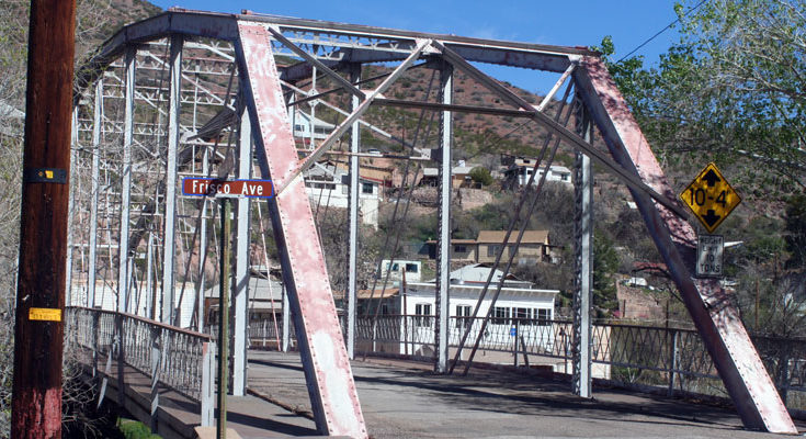
Walt Mares Photo/Gila Herald: The 102-year-old Zorrilla Bridge crossing the San Francisco River in Clifton will be closed to traffic beginning Monday, March 16. The plan is to reopen it sometime in September. It is the main route for traffic to Eastside Clifton. The bridge is covered with lead-based paint, which will be covered over by coats of new non-lead paint. The bridge’s roadway will be redone, from its supports underneath to its pavement.
Only access to Eastside Clifton to be through Park Avenue
By Walt Mares
CLIFTON – The historic Zorrilla Bridge that provides the main route of access to Eastside Clifton will be closed as of Monday, March 16. It is scheduled to be closed until September. That means there will be only one access road, a narrow one at that, to Eastside until the bridge is reopened. That road is Park Avenue.
The Zorrilla Bridge spans the flood-prone San Francisco River. The 102-year-old structure is being closed while it is being refurbished. That is, it will receive a new coat of paint over the entire structure and the bridge’s roadway will be replaced.
The cost of the project is $1,225,395 and will be overseen by the Arizona Department of Transportation (ADOT). According to Clifton Town Manager Rudy Perez, the cost, or most of the cost, is being covered by a grant obtained by ADOT. The project falls under an off-system program, meaning it is not a regular part of the state’s overall highway or road system. Part of the project cost will be covered by a Surface Transportation grant being made possible by the Southeastern Arizona Governments Organization (SEAGO).
The town’s share of the project is about $350,000, which will be obtained via the Highway Users Revenue Fund (HURF).
The primary reason for the project is to cover the bridge’s current paint job, which was done with a silver-colored lead-based paint that has covered the bridge for several decades. Beneath the silver is a reddish-brown primer paint, which is also lead-based. Both layers of paint will be removed via the lead mitigation project. The primer is most visible at one end of the bridge. That apparently has been caused by weathering over many years. When it was last painted is unknown.
A secondary purpose is to replace the bridge’s roadway. That will involve removing the road’s wooden supports and replacing them with metal. At present, when any vehicle, especially large pickup trucks, crosses the bridge it vibrates. The existing pavement is badly deteriorated.
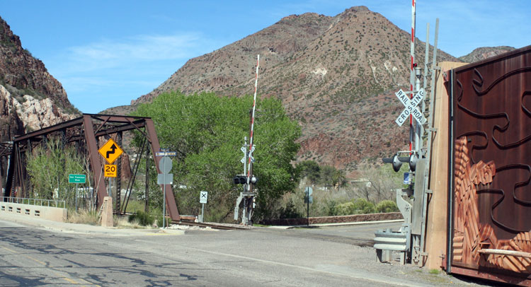
There is apparently little doubt about the bridge’s strength and stability. It survived the major flood of October 1-2, 1983. It remained intact while a similar style of bridge located upstream, known as the “Iron Bridge” or “Black Bridge,” was washed away during the flood. Floodwaters at times ran at 90,000 cubic feet per second in the narrow San Francisco River Canyon, where the Zorrilla Bridge is and the Black Bridge existed.
The Zorrilla bridge provides access to Park Avenue, which runs the length of Eastside. Now, the only access to Park Avenue will now be on the south side of the Coronado Bridge, which also spans the San Francisco River. The bridge carries U.S. Highway 191, the primary road through Clifton. It is heavily used. The ADOT daily traffic count through Clifton is about 6,000 vehicles. There is heavy shift- change traffic from the Morenci copper mine during mornings and afternoons. That means that those motorists turning on to Park Avenue will have to do so with much caution. Traffic on the bridge includes large semi-tractor trailers that service the Freeport McMoran copper mine in Morenci.
Busy? The Morenci facility is the largest operating open-pit copper mine in North America and employs thousands of people. Morenci is located about four highway miles from Clifton.
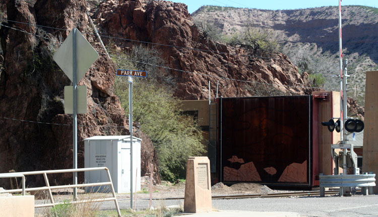
The closing of the bridge creates a challenge for motorists living in Eastside and will do so for those not very or totally unfamiliar with the town. The alternative route is through Park Avenue, which is narrow and barely accommodates two-way traffic. The river runs immediately along one side of the road. On the other side of the road are steep cliffs in which there are many large, loose rocks. During heavy rainstorms, it is not unusual for rocks, some of them bigger than a car, to tumble down on to the road.
There are about 50 homes there, most of which are located on hillsides Also to be affected are two businesses located on Eastside, the Blue Door Sanctuary, and the recently restored Clifton Hotel. Both provide bed and breakfast services. The hotel also has a bar. The Blue Door is one of five such businesses in Greenlee County whose structures are more than 100 years old.
For many years, the bridge was known as the Riley St. Bridge. A longtime pharmacy known as Riley Drug, owned and operated by Pete Riley, was located on the east side of the bridge and was located about 100 feet from the bridge. It was completely destroyed in the 1983 flood and was never rebuilt. It was an old-fashioned drug store that included a soda fountain and counter that was popular among teenagers. Only those who were teenagers or adults in 1983 will remember it. Otherwise, it has been completely forgotten.
The Zorrillas
The bridge, and Zorrilla Street, which at most is 100-yards long, was at some time during the past decade, named after a prominent family that emigrated from Spain to Clifton early in the 20th Century. The Zorrillas were merchants, ranchers, and more.
Gerardo Zorrilla, the family’s patriarch, established enterprises in which the family became engaged. That included cutting and selling firewood gathered in the hills. They also ran a “matanza,” which is Spanish for a slaughterhouse. The Zorrillas also raised Angora goats, which was a quite lucrative enterprise during World War II. Angora goat hair, which is very warm, was used for lining coats for pilots and their crews, who while flying at very high altitudes, experienced extreme cold.
Two brothers, Jesus and Manuelo, known as Lolo, ran a general merchandise store on historic Chase Creek for many years, until the 1990s. Jesus told of how Angora wool was often stored in caves located behind their store. When an order for the wool was received, the Zorrillas were ready to do business.
The brothers and their sister, Isabel Fernandez, lived well into their 80s. All have since gone off into the wild blue yonder.
For what it is worth, in Spanish, Zorrilla means “skunk.” None of the family ever mentioned being hassled or teased about their name.


