

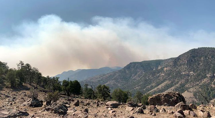
Contributed Photo By Michelle Post: Smoke from the Cow Canyon Fire billows into the air.
Fire is burning near Blue community
By Walt Mares
GREENLEE COUNTY – So, where is that smothering smoke coming from that is filling the air around Clifton-Morenci?
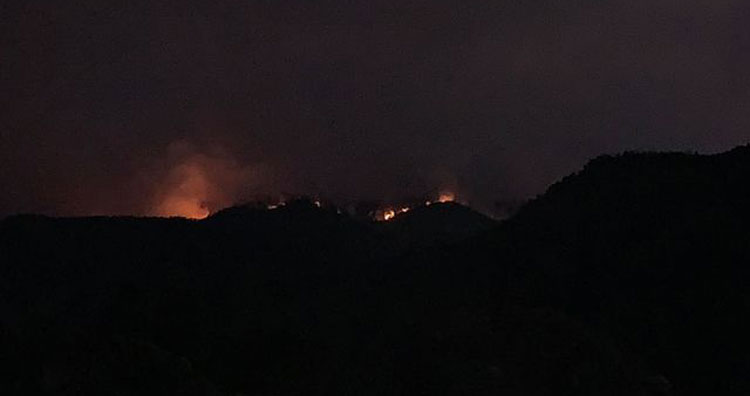
The smoke is coming from the Cow Canyon fire that at present covers 6,700 acres. It is burning north of Morenci-Clifton in a remote location in some pretty rough country.
Depending on which way the wind is blowing, smoke was heavy in Morenci and Clifton on Saturday, Oct. 3. It was heaviest in Morenci that morning causing eyes to water and for some folks in resulted in labored breathing. Morenci is 500 feet higher than Clifton, located in the narrow San Francisco Canyon. The air was hazy in Clifton and there was the tangy odor of smoke but it was not as bad as it was in Morenci.
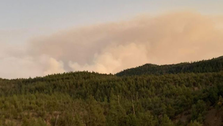
Smoke in the two communities was heaviest late Saturday morning but a gentle wind blew smoke moved from the area.
The sky was clear on Sunday but on Monday the odor of smoke was again prevalent, but nowhere as bad as it was Saturday.
The fire is burning within the Apache-Sitgreaves National Forests’ Blue Range Primitive Area near the Arizona and New Mexico state border.
As of Monday, Oct. 5, the Cow Canyon fire was 18 percent contained.
According to a U.S. Forest website, prior burnout operations around the Bear Mountain Lookout were tested Sunday as the main fire reached the mountain. Thanks to successful firefighting tactics that were deployed previously, no structures were impacted as a result of the progression of the fire.
Recent fire activity is most prevalent on the southeastern flank involving light to moderate ground fuels with some isolated torching. Fire officials will continue to monitor the fire’s progression and will utilize point protection when needed.
Values at risk
Firefighting efforts are focused on providing protection for structures, cultural resources, and historical sites, and thus far, no identified values at risk have been impacted by the fire.
Closures
The following trails are closed for public health and safety: Cow Flat Trail (#55) beginning at the trail junction of Bonanza Bill Trail (#23), following the Cow Flat Trail (#55) to the southwest until it meets the junction of WS Lake Trail (#54).
Lanphier Trail (#52) at the trailhead and the junction of National Forest Service Road (NFSR) 281, following the trail to the southeast until it meets Cow Flat Trail (#55).
South Canyon Trail (#53) at the trailhead and the junction of NFSR 281, following the trail to the southeast until it meets Cow Flat Trail (#55).
According to the website the closure order and map can be found at https://www.fs.usda.gov/detail/asnf/alerts-notices/?cid=stelprd3793918.
Jake Springs Fire
The Jake Springs Fire, ignited Monday, Oct. 4, on the Springerville Ranger District, Apache-Sitgreaves National Forests and the cause is currently under investigation. The fire is less than a mile southeast of Carnero Lake and is approximately 60 acres in size with 15 percent containment. The fire is actively burning in steep terrain through heavily mixed conifer and ponderosa pine. No road closures at this time, however, drivers should take caution near Highway 60 and 260 due to possible smoke in the area.
Currently, one Dozer, one Type 1 Helicopter, one Type 3 Helicopter, three Engine Crews, two Type 2 IA Handcrews, and one Suppression Module are assigned to the incident. Additional resources have been ordered and are responding. Updates will be provided as official information becomes available.
Smoke may be visible near the towns of Greer, Eager, Springerville, and Hidden Meadows. Smoke-sensitive individuals and people with respiratory or heart disease are encouraged to take precautionary measures. Information on air quality can be found on the Arizona Department of Environmental Quality’s webpage: https://azdeq.gov/.