

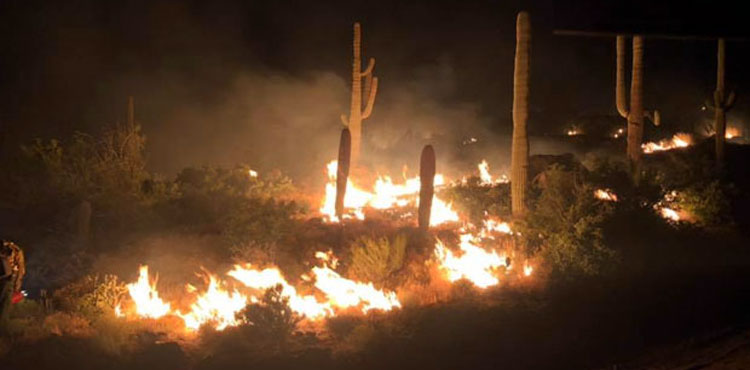
Photo By Daisy Mountain Fire Department: The Woodbury Fire has spread to nearly 66,000 acres as of Friday morning.
Evacuation ordered for Roosevelt area Thursday
By Jon Johnson
SUPERIOR – More than 1,100 firefighters from 21 different crews continue to battle the human-caused Woodbury Fire near Superior, which has grown to nearly 66,000 acres as of Friday morning with 42 percent perimeter containment.
On Thursday, the Gila County Sheriff’s Department issued an evacuation order for the Roosevelt area. First responders assisted the evacuation of residents and visitors from the Roosevelt Dam to the junction of State Highway 188/288 as firefighting activity sprawled out into towns and residential areas.
A shelter for evacuees is set up at the Lee Kornegay Intermediate School, 4735 S. Ragus Road, Miami, Arizona. A community meeting will be held at the Miami High School, 4735 Ragus Road, Miami, Arizona at 6 p.m. Friday night. For information regarding Gila County Emergency Management call 928-402-8888.

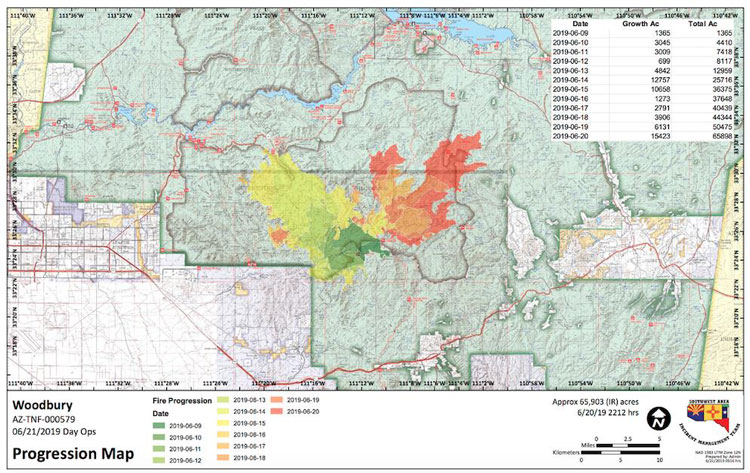
The wind-swept fire grew significantly to the north on Thursday and continued through Reavis Creek into the Two Bar area. Additionally, the fire spread past the Reevis Mountain School and Granite Mountain into the Little Campaign Creek and the Blackberry Spring areas.
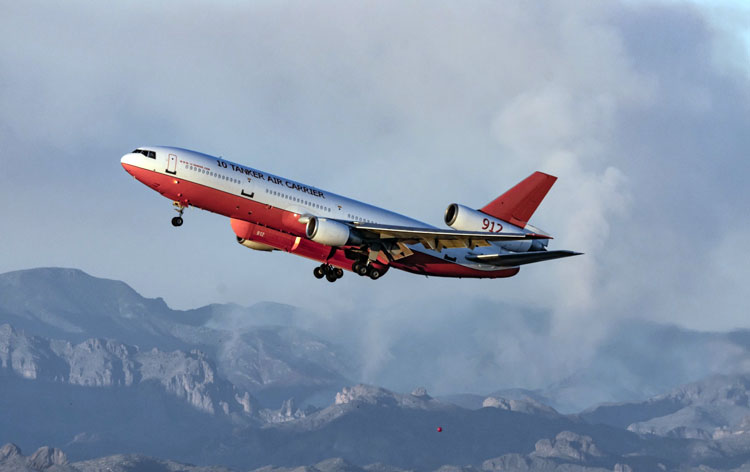
Hotshot crews and others are working around the clock fighting the fire, including doing burn out operations, constructing fire lines and receiving aerial support drops of water and fire retardant.
According to the Friday morning update, aircraft, including helicopters and air tankers, will still be working the fire event though variable wind gusts of up to 30 mph combined with single-digit humidity are expected for Friday. Firefighters expect more rapid growth to the north and east.
Current closures: The Tonto National Forest has closed the Superstition Wilderness and adjacent Forest. For more detailed information go to https://www.fs.usda.gov/alerts/tonto/alerts-notices.
State Highway 88 is closed from milepost 213 at Tortilla Flat to State Highway 188 at Roosevelt. Also, State Highway 188 is closed from State Highway 88 just west of Roosevelt at milepost 244 to State Highway 288. For current Arizona Department of Transportation information visit https://az511.gov/.
Due to extreme fire danger, the Superstition Fire & Medical District (SFMD) is restricting the sale and use of fireworks within its boundaries. For more information regarding the Fire District please visit their website at www.sfmd.az.gov.
The Forest Service Campgrounds at Roosevelt Lake east of Roosevelt Dam are closed. Tonto National Forest Stage 1 Fire Restrictions are in place.
The following areas remain open to the public: Lower Salt River, Saguaro Lake, Canyon Lake, and Tortilla Flat, some areas of Roosevelt Lake, Bartlett Lake, Lost Dutchman State Park and Oak Flat Campground.