
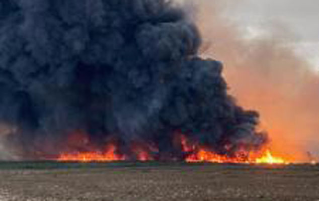
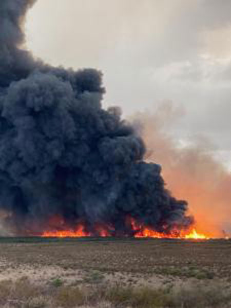
Photo Courtesy InciWeb: The Bottom Fire near Bylas has burned 4,489 acres along the Gila River.
By Jon Johnson
BYLAS – The Bottom Fire burning west of Bylas has scorched 4,489 acres along the Gila River and had a listed containment of 31 percent as of Friday.
The lightning-caused fire began June 28 roughly seven miles west of Bylas and is burning brush, tall grass, Chaparral, and Salt Cedar. Smoke plumes from the fire could be seen more than 50 miles away.
On Thursday, the Southwest Area Type 2 Incident Management Team 4 took command of fighting the fire and increased containment along the southern edge with cooperation from local resource advisors and the Eastern Arizona Railroad. The fire’s growth has been limited to the dry river bottom due to a lack of fuel outside of the channel, according to a news release.

Firefighters constructed a fireline from the southern side of the Gila River to establish a fire break along the eastern edge. The Eastern Arizona Railroad assisted by providing two masticators utilized to remove heavy vegetation along a 100-foot corridor along the railroad, protecting a wooden trestle that serves as a critical linkage along the line, according to the release.
Geronimo Hotshots conducted a burnout operation throughout the night to also help stop the fire’s movement to the east.
“With this approach, firefighters were able to strategically set fire inside their control lines to consume fuel between the edge of the main fire and the control line,” the release states. “With the success of these operations, fire crews are now focused on holding the constructed fireline and repairing the evidence of their suppression actions. With new lightning fires starting throughout the region, the Team is lending aircraft support as needed to help suppress other fires north of the Bottom Fire.”
A temporary flight restriction (TFR) is in place over the area, which includes unmanned aircraft, or drones. The unauthorized use of drones in a wildfire area endangers the lives of pilots and firefighters. Never fly an unmanned aircraft over or near a wildfire. See www.nifc.gov/drones for additional information on the dangers drones pose to wildland firefighting aircraft and personnel on the ground.
Smoke from the Bottom Fire may be visible from many communities in the vicinity of the fire, including Bylas, San Carlos, and Calva. Increased fire activity could result in heavy smoke on U.S. Highway 70, and drivers should remain cautious during travel. An interactive smoke map at https://fire.airnow.gov/ allows you to zoom into your location to see the latest smoke information. Smoke-sensitive individuals and people with respiratory problems or heart disease are encouraged to take precautionary measures.