

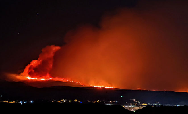
Contributed Photo: The Telegraph Fire has grown to 148,299 acres, with 59% containment as of Wednesday morning.
Fire expected to grow to the south of SR 77 and El Capitan area
Contributed Article
Telegraph Fire
Acres: 148,299
Percent Containment: 59%
Date/Time Detected: Friday, June 4, 2021, 1:30 p.m. Structures burned: 22
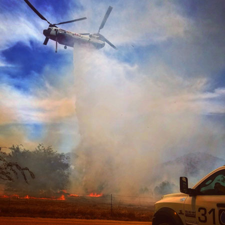
Number of Personnel: 1,038
Cause: Human, under investigation
Origin/Location: South of Superior, Arizona
The Mescal Fire has burned 77,250 acres as of Wednesday and was listed at 88% containment.
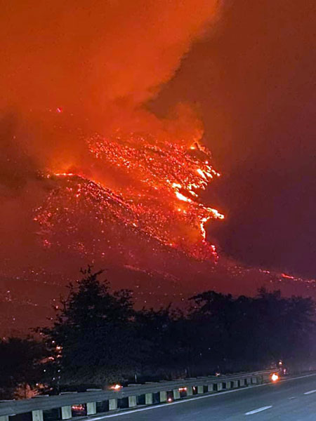
GILA COUNTY – Yesterday evening at about 6 p.m., strong outflow winds from thunderstorms pushed the fire south across Dripping Springs Road. Crews used a road above Ray Mine as an anchor point to burn out a containment line around the spot fire, preventing further spread. Crews continued to prep in and around the values at risk along the Dripping Springs Road. Firefighters burned-out fuel around the Telemundo communications tower on Signal Peak area to prevent damage to the tower. Structure protection crews worked to protect values at risk in the areas of El Capitan and along Dripping Springs Road.
Today, firefighters will maintain a heavy presence in the El Capitan communities, assessing damage and mopping up. Crews will search for opportunities to connect the old road and dozer line running northeast from Dripping Springs to the Mescal Fire perimeter, and the Structure Protection group will identify and protect values at risk along Dripping Springs Road. Fire crews will continue to clean up and repair Forest Road 651 to provide access for fire suppression activities. Assessment for suppression repair on the dozer line from Pioneer Pass Road east to State Route 77 north of the Grantham Ranch may begin today. In the U.S. Route 60 corridor, felling crews will remove hazardous snags within the interior of the burned area.
Today the BAER (burned area emergency response) team will begin an assessment of the burned area in the U.S. Highway 60 corridor in preparation for a rehabilitation plan. For information on evacuation status, road closures, and fire activity, there will be a virtual community meeting every day at 6 p.m. until further notice, on the Incident Facebook page: https://www.facebook.com/Telegraphfireinformation/.
Evacuation status for El Capitan (east and west), Dripping Springs, Wind Spirit, Hagen Ranch, Slash S Ranch, and Government Springs is now “Go.” Evacuation status for Top-of-the-World, Bellevue, Oak Flat, Beverly Hills, Six Shooter, and Icehouse and is now “Set.” Evacuation status for Superior, Globe, Miami, Claypool, Central Heights, Pinto/Carlotta, Skill Center, Fairgrounds, Schultz Ranch, and the Battle Axe area is now “Ready.”
The Tonto National Forest has initiated Stage 2 Fire Restrictions for the entire forest, effective 8 a.m. on June 11.
All State Land is under Stage 2 restrictions effective 8 a.m. on June 11.
The San Carlos Indian Reservation has initiated Stage 3 fire restrictions for the entire reservation, effective June 14, 2021.
All Bureau of Land Management lands in Arizona are under Stage 2 fire restrictions effective June 11, 2021. See https://blm.gov/arizona/fire-restrictions. CLOSURE AREAS: Tonto National Forest Closure Order Map: https://www.fs.usda.gov/alerts/tonto/alerts-notices. Bureau of Land Management Emergency Fire Closure Order and Map: https://www.facebook.com/BLMArizona/.