
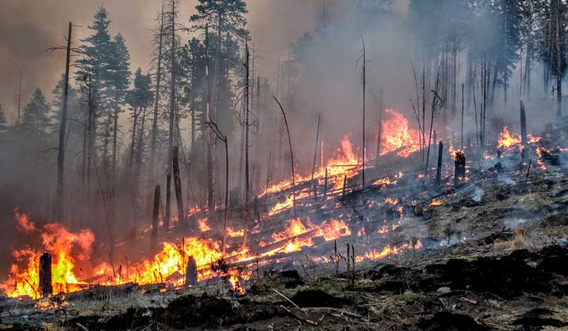
Photo Courtesy BIA Forestry & Wildland Management: The Rattlesnake Fire has grown to more than 26,000 acres.
Contributed Article By U.S. Forest Service
Łťiish bitseghál kó bighą nagoďíi
| Location: Southeast of Whiteriver, AZ | Cause: Human caused-under investigation | Percent containment: 63% |
| Start date: Wednesday 4-11-2018 | Size: 26,072 acres | Vegetation: Ponderosa pine and grass understory |
| Resources: 295 Personnel
|
Fire activity: Fire behavior was moderate Monday. Existing containment lines were maintained as near Red Flag conditions persisted through the day with sustained wind speeds near 15 miles per hour, gusts to 25, and relative humidity values dropping into the single digits. Crews continue to monitor and patrol containment lines on the western and northern flanks of the fire, fire activity is minimal in those areas.
Weather: Increasing clouds, with a high near 58 degrees. Southwest winds will continue across the area today at 13 to 23 mph, with gusts as high as 34 mph. The approaching front brings a chance of precipitation tonight into Wednesday.
Safety: Residents are reminded to drive with caution in the fire area due to potential smoke impacts on highway 191, and to be alert for fire traffic. Road closures remain in place on Forest Road 25 and other roads in the fire area.
Road and area closures: Forest Road 25 remains closed along with additional closures on the Apache-Sitgreaves National Forests, the San Carlos Apache Reservation, and the White Mountain Apache Reservation. Visit the Rattlesnake Fire Inciweb page for a map and details.
Fire restrictions: The Apache-Sitgreaves National Forests is currently in Stage 1 Fire Restrictions in order to reduce human-caused fires and protect public safety. San Carlos Apache Reservation implemented Stage 2 Fire Restrictions on April 17, 2018. Modified Stage 2 Fire Restrictions continue on the Fort Apache Indian Reservation.