

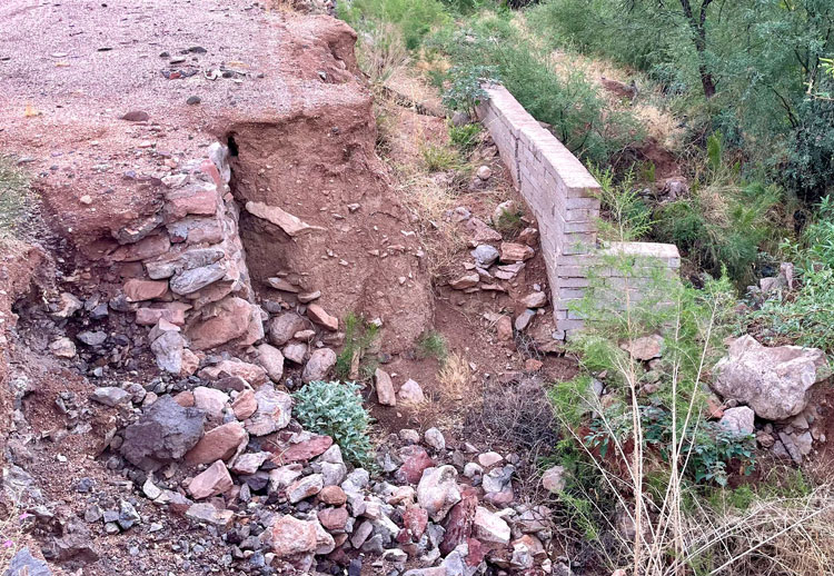
Contributed Photo/Courtesy ADOT: The Arizona Department of Transportation is proposing to invest $4 million to restore limited access to 5 miles of State Route 88 (Apache Trail) damaged by flooding in 2019. Shown is an eroded culvert east of Fish Canyon.
The interim project involves 5 miles extensively damaged by the 2019 flooding
Contributed Article/Courtesy ADOT
PHOENIX – The Arizona Department of Transportation is proposing to invest $4 million to restore limited access to 5 miles of State Route 88 (Apache Trail) damaged by flooding in 2019 as it seeks funding for more extensive upgrades needed to make the roadway more resilient and accessible.
At its meeting scheduled for 9 a.m. Friday, Jan. 12, in the city of Maricopa, the State Transportation Board will consider ADOT’s interim plan to restore the unpaved roadway to a condition that can accommodate vehicles with high clearance or four-wheel drive, as well as utility terrain vehicles.
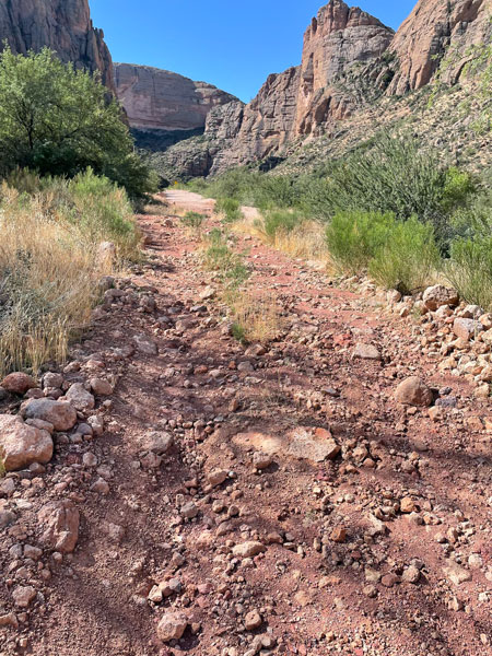
SR 88 closed in 2019 between Fish Creek Hill Overlook and Apache Lake Marina Road (mileposts 222-229) when flooding exacerbated by runoff from the Woodbury Fire scar extensively damaged the gravel roadway and left a section blocked by boulders. Flooding also damaged the drainage system, guardrail, and bridge approaches and left unstable rock faces, creating safety issues and making the road vulnerable to additional damage and closures. In 2022, ADOT reopened 1.7 miles west of Apache Lake to restore access to the Reavis Trailhead at milepost 227.
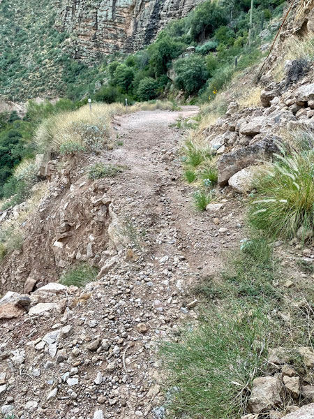
ADOT’s interim plan calls for removing boulders on Fish Creek Hill, mitigating rockfall as needed between Fish Creek Hill Overlook and Fish Creek (mileposts 222-223.5), making repairs to retaining walls, installing new signage, cleaning and potentially replacing damaged drainage culverts, and taking other steps to safely reopen the highway for high-clearance or four-wheel drive vehicles.
Maintenance crews are scheduled to begin work on preliminary items ahead of the construction project like removing vegetation, filling in eroded areas in the road surface, and cleaning out culverts, beginning in February. Subject to approval from the State Transportation Board contracted construction work would be expected to begin later this year. Before ADOT can schedule work, the U.S. Forest Service must review and approve the interim project design, since SR 88 follows an easement through federal land. In addition, the project must be designed to meet all applicable state and federal environmental requirements.
ADOT’s long-term plan for SR 88, developed through extensive public involvement and study, is intended to improve its resilience to severe weather. The recommendation calls for $33.7 million in improvements including:
- chip sealing, in which aggregate is compacted into heated asphalt liquid to create a more durable road surface, throughout the project area;
- widening the roadway to 15 feet in steeper areas;
- increasing drainage capacity to accommodate heavier rainfall;
- rehabilitating or repairing existing bridges; and
- adding pullouts and other safety enhancements.
The longer-term plan does not have dedicated funding, and ADOT is pursuing federal funding to advance those improvements.
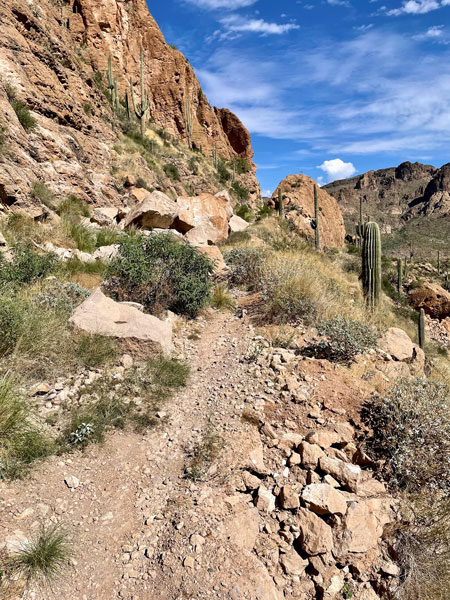
Traveling between the East Valley and Roosevelt Lake, the Apache Trail was built during the construction of the Theodore Roosevelt Dam, which was completed in 1911. Before closing in 2019, the stretch between Tortilla Flat and Apache Lake was used by an average of 232 vehicles daily.
ADOT has performed extensive work since 2019 to restore access to and improve other damaged sections of SR 88 and make regular repairs when flooding has damaged areas that are open to traffic. Motorists can safely access Apache Lake and other points on the east side of the closure via SR 188 and can travel 9 miles east from Tortilla Flat, which has been accessible throughout from the west. In addition, an $18 million project administered by the Federal Highway Administration’s Central Federal Lands Highway Division is currently chip-sealing 11 miles between Apache Lake and SR 188 near Theodore Roosevelt Dam.
The State Transportation Board meeting is at 9 a.m. Friday, Jan. 12, in the Maricopa City Council Chambers, 39700 W. Civic Center Plaza. Please visit aztransportationboard.gov for more information and a link to participate virtually.