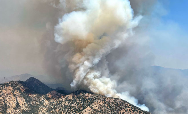
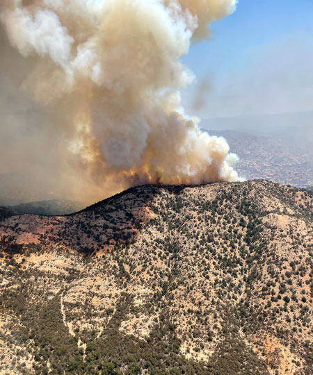
Contributed Photo: The Pinnacle Fire was listed at 27,807 acres with 15% containment as of Saturday morning.
Contributed Article/Courtesy Southwest Incident Management Team #3
Size: Approximately 27,807 acres – Location: Santa Teresa Mountains, Graham County, Arizona – Smoke: The Pinnacle fire is producing significant smoke. For current air quality click here – Containment: 15% – Cause: Under Investigation – Start Date: June 10, 2021 – Total Personnel: 428
SANTA TERESA WILDERNESS – Friday was another day of high heat and low humidity with the fire finding new sources of fuel. The result was another day of active fire behavior and the generation of a significant smoke column. At about 2 p.m., a large column of smoke could be observed as the fire consumed new fuels within the wilderness, causing it to move west.
Crews and fire managers worked thru the day and last night to prepare and plan for actions to mitigate the fire’s western movement once it travels to more manageable terrain outside the federally designated wilderness area. Fire managers will focus on this segment of the fire in the next few days.
The eastern perimeter of the fire remained calm with little to no smoke. Fire in the Black Rock Ranch area was moderate. However, at Black Rock, structure protection sprinklers, pumps, and water blivits remain in place, prepared to be activated should the fire again move in that direction. On the southwest section, firefighters continued to patrol and reinforce fire lines near Klondyke as the fire cools from recent suppression activities.
Currently assigned resources include four hand crews, four helicopters, 29 engines, 11 water tenders, and four dozers. Resource numbers are adjusted as operational needs are determined daily.
Evacuations:
GO: All Black Rock Road area residences, and all residences in the Klondyke-Aravaipa corridor in Graham County. For “Ready, Set, Go” information follow this link: https://wildlandfire.az.gov/ and https://ein.az.gov/ready-set-go.
Closures: The existing FAA-designated Temporary Flight Restriction for the fire area has again been adjusted to compensate for fire growth. Both the Coronado National Forest and the Bureau of Land Management have closure orders in effect.