
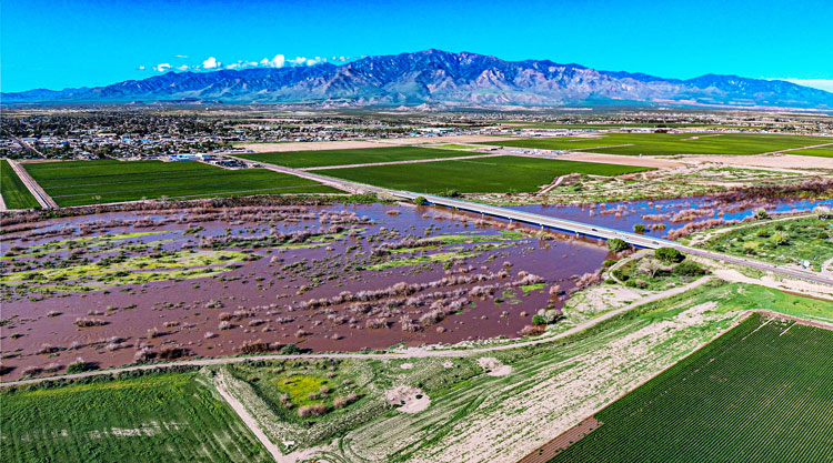
Jon Johnson Photo/Gila Herald: This picture of the Gila River at the 8th Avenue Bridge was taken at about 8 a.m. on Tuesday, Aug. 23. The river is swollen here, but still within its banks and flood zone.
No property damage from flooding Gila River is listed in Graham County
By Jon Johnson
SAFFORD – The Gila River rose to three-quarters of a foot from a major flood stage for the Safford area and forced the closure of Sanchez Road early Tuesday morning when water flowed over the roadway.
According to Graham County Undersheriff Jeff McCormies, the area will remain closed overnight and will be re-evaluated tomorrow.

The monitoring site at the Gila River at Head of Safford Valley, near Solomon, crested at 23.26 feet at 2:45 a.m., according to the United States Geological Survey (USGS). The action stage for that site is 19 feet, with a minor flood stage at 21 feet, moderate at 22.5 feet, and a major flood stage at 24 feet.
The USGS also measured top streamflow of 21,300 ft3/2 at 1 a.m. at the site.
According to Graham County Dispatch notes, a report of water spilling over the Solomon Bridge on Sanchez Road came in at about 5:14 a.m. Dispatch advised that highway workers put signs on both sides of the bridge due to the roadway being flooded as well as a barricade on the south side after the situation escalated. Dispatch also noted that workers were putting signs and barricades on the Eden Bridge.
By 11:45 a.m., the site measured the height of the Gila River to be at 19.8 feet, and the streamflow was at 10,200 ft3/s.
While roads were closed no property damage from flooding has been reported. However, further to the west may still present problems on the San Carlos Apache Reservation and additional rainfall in the headwaters in New Mexico is in the forecast.
The town of Duncan has issued an emergency proclamation after flooding hit it early Monday morning, inundating businesses and some homes with water. After seeing a high of 23.2 feet at 5:15 a.m. on Monday, the Duncan site was down to 18.5 feet by 7:45 a.m. on Tuesday, but as of 1:30 p.m., the river has risen about a foot to roughly 19.5 feet.