

Gila Herald Staff Reports
GRAHAM & GREENLEE COUNTIES — Local authorities and the National Weather Service urge residents to prepare for severe weather as a potent storm system moves into the region Wednesday and Thursday.

The Graham County Department of Health and Human Services issued a public service announcement warning of an elevated chance of severe thunderstorms and isolated flash flooding. Forecasters project severe winds exceeding 60 mph, hail, and possible tornadoes. Heavy rainfall totals are expected to reach 0.5 to 1.0 inches in the valley, with 1 to 2 inches or more anticipated on Mount Graham. Rain chances are expected to diminish by Friday and Saturday, leaving behind only localized showers and thunderstorms.
Rock Debris and Clean-Up Underway in Clifton
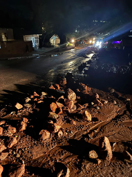
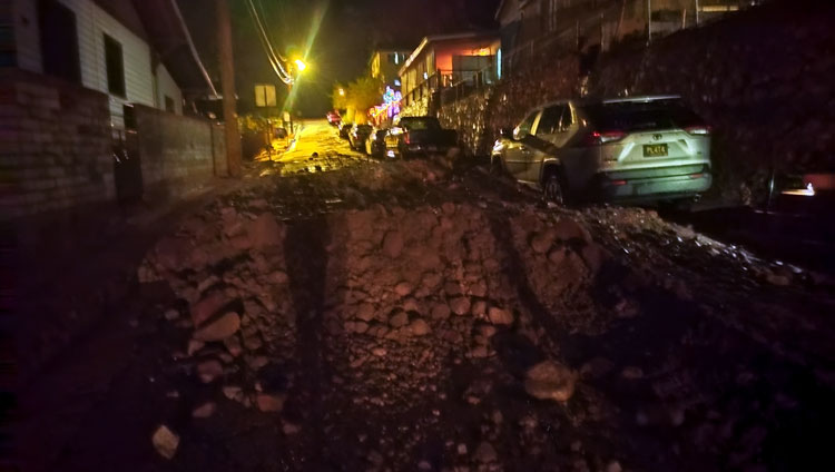
The incoming storm threat follows recent weather activity that has already impacted neighboring Greenlee County. In Clifton, heavy runoff and severe weather caused rock debris to cascade from the cliffs onto local streets, particularly Turner Ave., the Flats area, and Wards Canyon.
Debris piles reaching 5 to 6 feet have accumulated in some residents’ yards, leaving certain homeowners unable to open their back doors. Public works crews are actively clearing the roadways. Officials urge the public to avoid the Flats and Wards Canyon areas while heavy equipment and crews work in tight spaces with limited visibility.
Safety Recommendations
- Avoid Work Zones: Stay clear of public works crews operating in Clifton so they can clear debris safely and quickly.
- Monitor Forecasts: Keep tuned to the National Weather Service for real-time weather updates, warnings, and flash flood alerts.
- Secure Property: Secure loose outdoor items that 60+ mph winds could pick up.