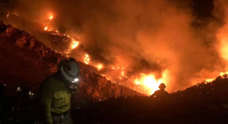
Photo Courtesy Mesa Interagency Hotshot Crew: Wildland firefighters battle the Pinnacle Fire on the ground up close.
Pinnacle Fire
Size: Approximately 4,668 acres Containment: 0% Cause: Under Investigation
Location: Santa Teresa Mountains, Graham County, Arizona Start Date: June 10, 2021
Incident Commander: Dave Gesser Total Personnel: 240
Pinnacle Fire Triggers Evacuation of Local Residence
By mid-afternoon yesterday fire weather conditions were extreme with single digit humidity and temperatures over 100 degrees resulting in active fire behavior. The Pinnacle Fire moved south, north, and east yesterday. Fire managers used retardant and bulldozers to halt fire movement southward onto State Trust Lands while hand crews concurrently worked directly on adjacent portions of the fire. By Saturday evening the fire had crossed management action points triggering the Graham County Sheriff’s office to evacuate one residence on the southeast flank of the fire.
During a critical operation Saturday afternoon, a privately owned drone was observed inside the FAA established Temporary Flight Restricted area around the fire. The result was that flight operations had to be stopped until the drone was clear of the area. Such incursions are unlawful by federal law. Worse, fire fighters have enough life-threatening hazards to deal with in the absence of losing critical air support. If apprehended and convicted, the drone’s pilot faces federal civil and criminal fines that will cost the violator thousands of dollars. These charges aren’t merely traffic infractions, rather they have hefty penalties including jail time associated with conviction. If you fly, we can’t.
Currently assigned resources include 5 hand crews, 3 helicopters, 13 engines, 5 water tenders, and 2 dozers. Large air tankers are also available and being used as needed to support fire fighters. More resources have been ordered and are steadily arriving. This fire is producing high quantities of smoke. During wildfire activity, firefighters can do little to reduce smoke impacts. Affected communities should remain aware of smoke advisories and conditions. Learn more at: airnow.gov.
Evacuations: One residence southeast of the fire and north of Aravaipa/Klondyke road area was placed in GO evacuation status as of 9 p.m. yesterday, others remain in “Ready” status. Residents living near the fire are encouraged to visit the following links for Ready, Set, Go information:https://wildlandfire.az.gov/https://ein.az.gov/ready-set-go

Closures: A Coronado National Forest Closure Order is being developed for roads and trails within the immediate fire area. A Temporary Flight Restriction has been enacted for the surrounding area by the Federal Aviation Administration.
Restrictions: The Coronado National Forest has implemented Stage 2 fire restrictions. For detailed information on restrictions see:https://www.fs.usda.gov/Internet/FSE_DOCUMENTS/fseprd915424.pdf