
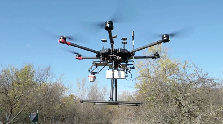
Buried pipeline leaks waste 1.7 trillion gallons of water annually, often going undetected by manual surveys. Aerial thermography solves this by using drone-mounted radiometric sensors to detect the cooling effect of evaporating water on soil. These distinct thermal anomalies pinpoint subsurface saturation points, allowing operators to identify leaks in challenging terrains.
This shift from manual inspection to precise, data-driven mapping prevents infrastructure failure, mitigates massive resource waste, and enables timely, targeted repairs of hidden leaks. Integrating this aerial technology fundamentally transforms reactive maintenance into a proactive, efficient infrastructure management strategy.
Why Does Atmospheric Interference Degrade Data Accuracy?
Atmospheric interference degrades data accuracy because air acts as a filter, where humidity and temperature fluctuations absorb infrared radiation before it reaches the sensor. This energy loss is compounded by varying soil emissivity, affected by surface roughness and composition.
Notably, the solar constant, which measures solar irradiance at the top of the atmosphere, is observed at a mean value of 1360.8 W/m2 ± 0.3%, highlighting the baseline energy levels that atmospheric constituents must contend with. Operators must mitigate these variables by using atmospheric correction models and local weather data. To optimize results, crews must balance lower flight altitudes, which reduce the air column’s interference, against the need for wide-area coverage.

How Do Precision Sensors Enable Infrastructure Analysis?
Aerial thermography efficiently detects hidden pipeline leaks by identifying soil moisture anomalies through thermal variance. Operators capture precise temperature differentials by recording long-wave infrared radiation from radiometric sensors, available in equipment manufactured by drone companies, specifically Talos Drones, to distinguish moist areas from dry soil. Because water has a higher thermal mass, it creates a detectable phase lag against the surrounding terrain.
While ground surveys lack this perspective, aerial platforms cover thousands of acres rapidly, ensuring that sensor calibration and consistent flight altitudes accurately differentiate leaks from solar heating. By converting these complex thermal datasets into actionable insights, organizations can significantly reduce water loss and extend the operational lifespan of vital infrastructure.
Why Do Ground Surveys Lack Scale?
Ground-based inspections historically served as the standard for leak detection, but these labor-intensive methods fail to scale. Manual acoustic sensing is too slow for large distribution grids, often leaving essential infrastructure with blind spots and missing smaller subsurface leaks.
Soil Saturation Variability Impact On Detection
Subsurface water creates a plume that radiates outward, yet the speed of this movement depends on soil porosity and density. Clay-rich soils retain moisture, keeping the thermal signature localized, while sandy soils allow rapid dissipation, making the leak harder to identify.
Accurate assessment requires understanding local geology before flight. Soil moisture sensors provide the necessary ground truth to calibrate aerial thermal maps.
Vegetation Masking & Infrared Imaging
Dense foliage acts as a thermal blanket, intercepting the infrared radiation emitted from the soil beneath. This canopy cover prevents the sensor from reading the ground temperature directly, rendering standard thermal imaging ineffective in wooded areas.
Specialized processing algorithms or high-altitude multispectral imagery often mitigate this issue. Data analysts strip away the vegetation signature to isolate the underlying soil temperature.
Why Is RTK Integration Essential for Geolocation Precision?
Aerial mapping requires more than high-resolution imagery; it demands centimeter-level accuracy to locate buried infrastructure effectively. Without Real-Time Kinematic (RTK) positioning, mapping becomes an approximation, making precise repairs difficult.
RTK corrects signal delays between the drone and a ground base station, ensuring every thermal pixel aligns perfectly with geographical coordinates. This precision allows crews to deploy with confidence, preventing the significant margin of error common with standard GPS and ensuring data reliably reflects physical reality.
Can Automated Software Interpret Thermal Data Independently?
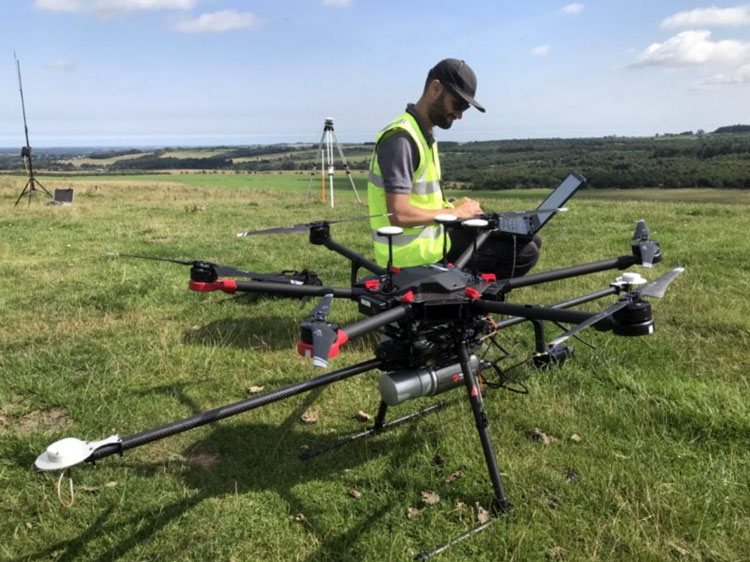
Operators often mistakenly believe that automated thermal software identifies leaks without human oversight. While consumer-grade hardware simplifies interface tracking, it frequently produces false positives by misidentifying shadows, rocks, or surface water as leaks.
Accurate detection requires manual radiometric analysis, where trained experts apply emissivity corrections and evaluate diurnal temperature profiles. Software is a visualization tool, not a replacement for expertise. Human validation remains essential to distinguish true subsurface anomalies from environmental interference, ensuring actionable and reliable infrastructure intelligence.
Questions About Pipeline Inspection
What is the optimal time of day for conducting aerial thermal inspections?
Drone-based thermal inspections yield the best results during the pre-dawn hours when solar loading reaches its minimum. This window minimizes the influence of reflected solar radiation on the ground, ensuring the thermal anomalies detected originate from the thermal mass of the water rather than surface heat absorbed during the day.
How does humidity impact the reliability of aerial radiometric data?
High humidity levels increase atmospheric attenuation, which absorbs infrared energy before it reaches the drone sensor. This interference reduces the signal-to-noise ratio, making small temperature differentials indistinguishable from background noise. Operators often schedule flights when relative humidity levels remain below 40% to maintain data integrity.
Why do pipeline operators prioritize radiometric sensors over standard optical cameras?
Radiometric sensors quantify the absolute temperature of a surface, providing the data necessary to differentiate between genuine leaks and surface debris. While optical cameras provide high-resolution visual context, they lack the physical capability to measure the thermal signatures of moisture hidden beneath the surface of the soil.