

Sandbags are available
Gila Herald Staff Reports
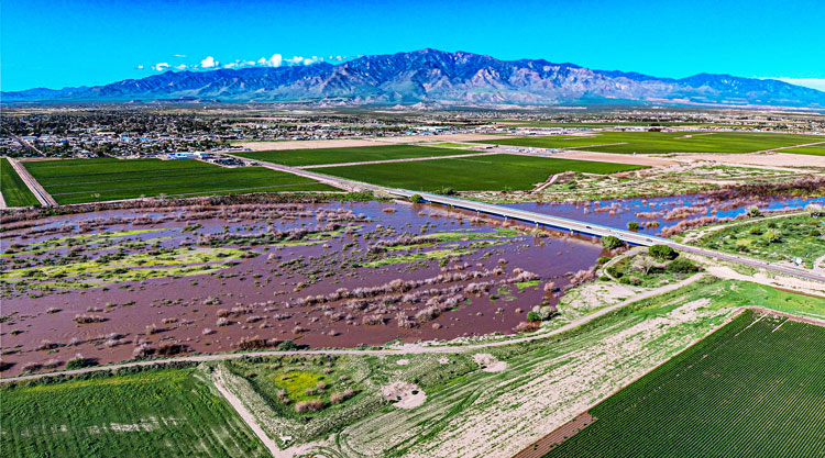
GRAHAM COUNTY — Local public safety agencies have issued an urgent advisory warning Gila Valley residents to prepare immediately for rising Gila River levels, with significant flooding expected to begin Tuesday night and persist through Wednesday.
According to officials, the Gila River is projected to breach its banks by 9 p.m. tonight, impacting local bridges and spilling into surrounding farm fields. Conditions are expected to worsen as floodwaters rise, with water expected to reach low-lying homes and businesses near the river by 11 p.m., as the river is expected to peak at about 23.5 feet.
Public safety officials strictly advise all residents to stay clear of flooded areas and low-water crossings. Under no circumstances should motorists or pedestrians attempt to cross standing or moving floodwaters.
Sandbag Locations and Distribution
To help residents protect their homes and properties, local municipalities across Graham County have established sandbag distribution locations:

- Graham County: Sandbags are available at the Graham County Fairgrounds in the Agriculture Building parking lot. Distribution is capped at 10 bags per household.
- City of Safford: Pick up sandbags at the MYOC Building, located at 405 W. Discovery Park Blvd. Distribution is capped at 10 bags per household.
- Town of Thatcher: Sandbags are available at the Public Works Building on Reay Lane.
- Town of Pima: Sandbags are available at the Town Yard, located at 200 East 300 North.
Residents living in flood-prone areas are urged to secure their properties, stock essential supplies, and monitor local news and public safety channels for further updates as conditions develop.