
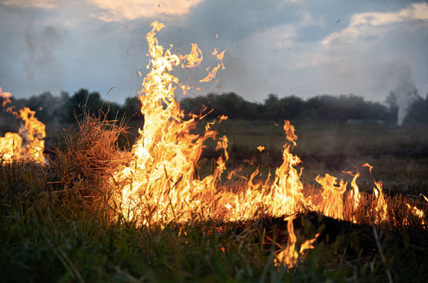
The threat is not abstract. In 2024, wildfires destroyed more than 4,500 structures across the United States, with the Southwest experiencing the most destruction of any region. For Gila Valley residents — many of whom live in wildland-urban interface zones where homes meet dense vegetation — preparedness is not optional. It is the difference between a manageable emergency and a catastrophic one.
Why Gila Valley Faces Elevated Risk
The geography here works against residents during fire events. Steep canyon terrain accelerates wind patterns, pushing fire upslope faster than most people expect. Dry monsoon conditions, common in late spring and early summer, create tinder-dry fuel loads from the prior season’s vegetation. Officials have warned that in critical drought years, even a minor ignition event can spread rapidly without the need for extreme weather conditions.
The Human Factor
Up to 80% of all wildfires are caused by human activity. In the Gila Valley region, common ignition sources include unattended campfires, equipment sparks from agricultural machinery, power line contact with dry vegetation, and escaped debris burns. Residents should treat any outdoor burning or open flame use during red flag conditions as a serious hazard, regardless of how routine it may seem.
Defensible Space Around Your Home
Defensible space is the buffer between your home and the vegetation surrounding it. This does not guarantee survival, but it significantly improves the odds — for both your property and the firefighters defending it. The Arizona Department of Forestry and Fire Management identifies three Home Ignition Zones that require active management: the Immediate Zone from 0 to 5 feet, the Intermediate Zone from 5 to 30 feet, and the Extended Zone from 30 to 100 feet.

Zone-by-Zone Priorities
Each zone has distinct tasks that reduce the fire’s ability to reach your structure:
- Immediate Zone (0–5 ft): Remove all combustible materials, including wood mulch, dead vegetation, and stored firewood. You should use non-flammable ground cover like gravel or stone.
- Intermediate Zone (5–30 ft): Space plants and shrubs so fire cannot ladder from ground to canopy. It is essential to trim shrubs to a height of two feet and maintain a clear space of at least four feet between plants, and remove dead material regularly.
- Extended Zone (30–100 ft): Thin vegetation and reduce fuel density. On slopes steeper than 20 percent, you should extend treatment an additional 100 feet from structures to account for accelerated fire spread.
Just as people increasingly turn to established review platforms to verify something before committing to it, reliable sourcing is the foundation of sound decision-making in any high-stakes context. A careful researcher, for instance, would consult a dedicated platform to identify safe online casinos in Canada before making any financial commitment — because accuracy and trustworthiness matter. The same logic applies directly to wildfire preparedness: official agency guidance, not secondhand advice, should always drive your planning.
The Alert Levels and When to Act
Arizona’s emergency notification system uses a three-stage framework to guide resident response. Understanding each level before a fire occurs saves critical time when one does.
| Alert Level | What It Means | Recommended Action |
| Ready | Wildfire risk is elevated in your area | Review evacuation plan, assemble go-bag, monitor alerts |
| Set | Wildfire is nearby; evacuation may be needed | Prepare to leave immediately, load the vehicle, and secure the pets |
| Go | Evacuation is ordered | Leave immediately via designated routes — do not delay |
Sign up for Gila County emergency alerts through the official website of the Gila County Government to ensure you receive notifications in real time.
Your Go-Bag and Evacuation Plan
Waiting until a “Set” or “Go” alert to start packing wastes the time you need most. A go-bag should be assembled well in advance and kept in a consistent, accessible location. Essential items include water, non-perishable food, current medications, a battery-operated radio, durable flashlights, extra batteries, and phone chargers — and your vehicle should always maintain at least half a tank of fuel.
Beyond supplies, your plan should include the following:

- Two identified evacuation routes from your property in case one is blocked by fire or smoke
- A designated out-of-area contact that all household members can check in with
- Pre-arranged accommodations or a contact outside the affected zone for temporary shelter
- Copies of vital documents — insurance policies, identification, medical records — stored digitally or in a fireproof location.
Staying Informed Year-Round

Wildfire risk in Gila Valley does not begin and end with a calendar date. While fire risk peaks from March through June, the threat exists year-round, particularly during periods of drought. Bookmark the Arizona Department of Forestry and Fire Management’s active fire information page, monitor the National Weather Service’s red flag warning alerts, and check the AZ WRAP portal to understand the specific risk rating for your property. Preparedness built before fire season is the only kind that matters when a fire starts moving.