Favorable weather conditions in place for hazardous fuels reduction work
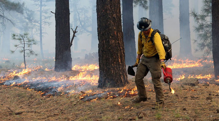
SPRINGERVILLE — The Apache-Sitgreaves National Forests are planning prescribed fire operations beginning Wednesday, March 18, pending all required approvals. We estimate this work to be completed by April 30. We use prescribed fires to help reduce overgrown vegetation to help protect local communities, infrastructure and natural resources from wildfires.
Lakeside Ranger District planned prescribed fire operations may include:
- Pine Rx, 552 acres, 1 mile east of Pinedale, and south of Hwy 260 (map attached).
- Thomas Rx, 591 acres, 1 mile west of Pinedale, and ½ mile southwest of Hwy 260 (map attached).
- Brushy Mountain North Rx, 1,353 acres, 9 miles east of Pinetop-Lakeside, and 6 miles southwest of Vernon.
- Telephone Rx, 236 acres, 10 miles east of Pinetop-Lakeside, and 5 miles southwest of Vernon.
Those areas may close to the public for several days for public safety. Watch for warning signs along roads near all prescribed fire areas before and during burns.
Smoke may be visible from Pinedale, Linden, Hwy 260, Hwy 77, Snowflake, Taylor, Vernon, Concho, Pinetop-Lakeside, and McNary. For more detailed information about air quality, go to AirNow online or download the app. When driving, slow down and turn on your headlights when you encounter smoke on the road.
We will evaluate weather conditions in the hours before a burn begins. If conditions warrant, scheduled prescribed fire activities may be canceled.
Stay informed about the scheduled prescribed fires through the forest website, social media channels, and InciWeb, the interagency incident information system. We will notify county emergency management officials when burning begins.
About the Forest Service: The USDA Forest Service has for more than 100 years brought people and communities together to answer the call of conservation. Grounded in world-class science and technology– and rooted in communities–the Forest Service connects people to nature and to each other. The Forest Service cares for shared natural resources in ways that promote lasting economic, ecological, and social vitality. The agency manages 193 million acres of public land, provides assistance to state and private landowners, maintains the largest wildland fire and forestry research organizations in the world. The Forest Service also has either a direct or indirect role in stewardship of about 900 million forested acres within the U.S., of which over 130 million acres are urban forests where most Americans live.