
Favorable weather conditions in place for hazardous fuels reduction work
Contributed Article/Courtesy USDA
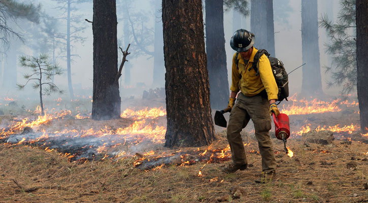
SPRINGERVILLE — The Apache-Sitgreaves National Forests plan to begin prescribed fire operations this fall, pending all required approvals. We estimate this work to continue through spring 2027, as weather conditions allow. We use prescribed fires to help reduce overgrown vegetation and protect local communities, infrastructure, and natural resources from wildfires.
Prescribed fires planned for the area include:
Black Mesa Ranger District
- Vincent (2,258 acres) – south of Dutch Joe Ranch
- Dye (4,966 acres) – 2 miles southeast of Dutch Joe Ranch
- Sinkhole (876 acres) – 4 miles southwest of Forest Lakes, north side of Hwy 260
Lakeside Ranger District
- Morgan Tank 5 (1,465 acres) – 1 mile southwest of Show Low
- Apprentice (2,375 acres) – 5 miles northeast of Pinetop
- Rhoton Seep (2,609 acres) – 4 miles northeast of Pinetop
- Brushy Mtn North (300 acres) – 4 miles east of Pinetop
- Brushy Mtn South (887 acres) – 3 miles east of Pinetop
- Telephone (1,676 acres) – 6 miles northeast of Pinetop
- Arab (674 acres) – 1 mile southwest of Vernon
- Butler West (788 acres) – 2 miles south of Vernon
Black River Zone (Alpine and Springerville Ranger Districts)
- Wallow West Unit 6BC (7,236 acres) – 5 miles south of Big Lake
- Luna (2,158 acres) – 1 mile east of Alpine, north side of Hwy 180
- Heifer (3,116 acres) – 8 miles southwest of Alpine, 1 mile east of Buffalo Crossing
Clifton Ranger District
- EEMS Phase 2 Block A (Bear) (5,000 acres) – 6 miles south of Blue Vista Overlook, west side of Hwy 191
- Hagen (5,757 acres) – 3 miles south of Blue Vista Overlook, west side of Hwy 191
Those areas may be closed to the public for several days for public safety. Watch for warning signs along roads near all prescribed fire areas before and during burns.
Residents may experience smoke during the prescribed burns. Visit https://fire.airnow.gov/ for more detailed air quality information. When driving, slow down and turn on your headlights when you encounter smoke on the road.
We will evaluate weather conditions in the hours before a burn begins. If conditions warrant, we may postpone or cancel scheduled prescribed fire activities. Please do not report these fires, as firefighters will remain on scene throughout ignitions and patrol afterward.
Stay informed about the scheduled prescribed fires through the forest website, social media channels, and InciWeb, the interagency incident information system. We will notify county emergency management officials when burning begins.
About the Forest Service: For more than 100 years, the USDA Forest Service has brought people and communities together to answer the call of conservation. Grounded in world-class science and technology– and rooted in communities–the Forest Service connects people to nature and to each other. The Forest Service cares for shared natural resources in ways that promote lasting economic, ecological, and social vitality. The agency manages 193 million acres of public land, assists state and private landowners, and maintains the world’s largest wildland fire and forestry research organizations. The Forest Service also has a direct or indirect role in stewarding about 900 million forested acres in the U.S., including over 130 million acres of urban forests where most Americans live.