Staff Reports
MOUNT GRAHAM — After months of winter closure, the upper reaches of State Route 366, known as Swift Trail, will reopen on Wednesday, April 15, giving drivers, hikers, anglers, and campers renewed access to the scenic heights of Mount Graham in the Pinaleño Mountains south of Safford.
The seasonal gate, located about half a mile past the end of the pavement near Shannon Campground, is scheduled to open, weather and road conditions permitting. The Arizona Department of Transportation (ADOT) and the Coronado National Forest manage the route, which typically closes each November due to snow and reopens in mid-April. While the exact timing can shift based on lingering snowpack or other mountain conditions, this year’s scant snowpack is not an issue.

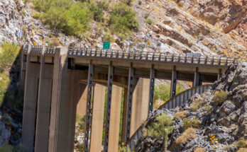
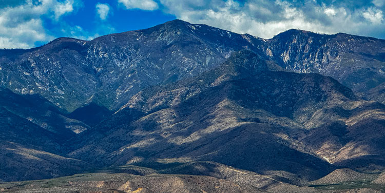
The Swift Trail offers one of Arizona’s most dramatic drives, climbing from desert lowlands near U.S. Highway 191 through multiple ecological zones — the equivalent of traveling from Mexico to Canada in a single afternoon. The paved lower section gives way to an unpaved road higher up, with switchbacks, panoramic views of the surrounding ranges, and access to campgrounds, trails, and forested ridges that reach nearly 10,000 feet.
A major draw is Riggs Flat Lake, a small, trout-stocked reservoir at about 8,700 feet elevation ringed by ponderosa pines. The lake and its adjacent campground become accessible again once the upper road opens. Anglers can target rainbow and brown trout (stocking details are available from Arizona Game and Fish), while visitors enjoy picnicking, short hikes, and cool mountain air far removed from the desert heat below. A day-use pass may be required at the lake area.
Other recreation opportunities along the reopened section include hiking and mountain biking trails, horseback riding, dispersed camping, and viewpoints such as Chesley Flat. The area is part of the Swift Trail Parkway, a designated scenic route that also provides access to the Mount Graham International Observatory and higher peaks, though some side roads may have additional restrictions.
Motorists are reminded to drive cautiously on the narrow, winding, and partially unpaved road. High-clearance vehicles are recommended for the unpaved portions, especially after winter. Services are limited at higher elevations, so drivers should carry plenty of fuel, water, and supplies. The upper road is expected to remain open through mid-November 2026, barring early snow.
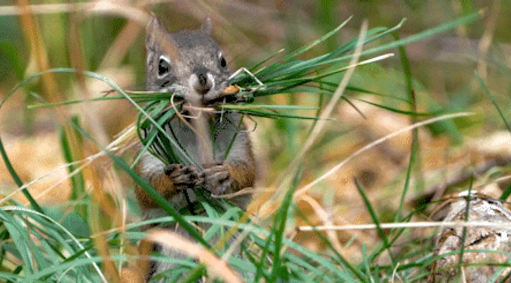
The reopening marks the start of the high-country recreation season on Mount Graham, a “sky island” known for its biodiversity, including the endangered Mount Graham red squirrel. Visitors are encouraged to practice Leave No Trace principles and respect wildlife closures that protect sensitive habitats.
For the latest conditions, road status, and recreation alerts, check the Coronado National Forest website or ADOT’s traveler information resources. With spring arriving in the high country, the Swift Trail once again invites Arizonans and visitors to experience the beauty of Mount Graham’s alpine meadows, forests, and lakes.