Staff Reports
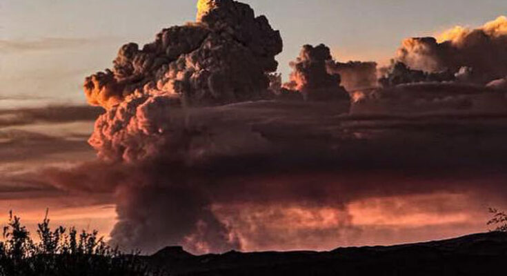
BYLAS – The Goodwin Fire, burning 12 miles southwest of Bylas, Arizona, exhibited minimal growth yesterday despite hot, dry, and windy conditions, according to the latest update from fire officials. Sparked by lightning on Aug. 6, the fire has consumed 1,010 acres of short grass, brush, and juniper, with 0% containment. A total of 111 personnel are currently assigned to the incident.
Firefighters made significant progress along Tribal 64 Road, extinguishing hot spots on the fire’s edge and focusing efforts on securing the southeast flank while moving west. Crews are navigating rugged terrain to scout potential control lines and improve road systems, with aerial resources, including a Type 1 helicopter, assisting in cooling hot spots. Weather forecasts indicate high-based showers and thunderstorms with minimal rainfall, posing risks of lightning and gusty outflow winds. Temperatures, though slightly cooler, remain above normal.
Public safety remains the top priority, with officials urging the public to avoid the fire area due to a Temporary Flight Restriction (TFR) in place. Drones are strictly prohibited, as they can disrupt firefighting operations. Smoke from the fire may become more visible, and sensitive individuals are advised to visit https://fire.airnow.gov/ for guidance.
Bronco and Indian Creek Fires pose ongoing challenges
Elsewhere, the Bronco Fire, burning 30 miles northeast of San Carlos, and the Indian Creek Fire, 10 miles southwest of Whiteriver, Arizona, continue to test firefighting efforts. Both fires, also ignited by lightning, have scorched 17,997 and 2,511 acres, respectively, with 0% containment. A combined total of 469 personnel are assigned to these incidents, managed by the Southwest Area Incident Management Team 4 (SW Team 4) since Aug. 10.
The Bronco Fire, burning grass, brush, and timber on the San Carlos Apache Reservation, is being addressed with a full-suppression strategy. Firefighters are securing the southern perimeter along the 100 and 1400 roads and building firelines along the Y2 Road to prevent northward spread. Winds from the northwest may challenge containment efforts.
The Indian Creek Fire has seen success in holding the fire south of the Y2 Road, with crews working to establish firelines along the Y4 Road where fuels are sparser. On Saturday, firefighters halted the forward progress of the Four Diamond Tank Fire, a new 4-acre blaze north of Indian Creek, and remain vigilant for additional fire starts due to lightning.
Extreme drought and dry fuels, exacerbated by a lack of winter snow and monsoon rains, have fueled rapid fire growth. Afternoon thunderstorms may bring erratic winds and increase fire activity. Smoke from both fires is impacting White Mountain communities, and residents are encouraged to take precautions (https://fire.airnow.gov/).
A community meeting was held on Aug. 10 at the Assembly of God Church in Cedar Creek to update residents on the Indian Creek Fire. The recorded meeting is available on the BIA Forestry & Wildland Fire Management – Fort Apache Agency Facebook page.
Closures and restrictions
The Fort Apache Reservation has implemented closures from Amos Wash to Black River, east to the Bonito Creek and Black River confluence, north along Bonito Creek to the Y40 bridge, northwest along Y40 to the Y70/40 junction, northwest along Y79 to Seven Mile, south to Fort Apache Road, and west to Highway 73. The San Carlos Apache Reservation is under Stage 3 fire restrictions, prohibiting campfires and closing higher elevations, including Point of Pines, Hilltop, Route 8, and Seneca areas. For inquiries, contact the White Mountain Apache Tribe EOC at (928) 475-2326 ext. 352 or 321.
Fire officials emphasize that public and firefighter safety remains paramount as crews work to contain these wildfires under challenging conditions.


